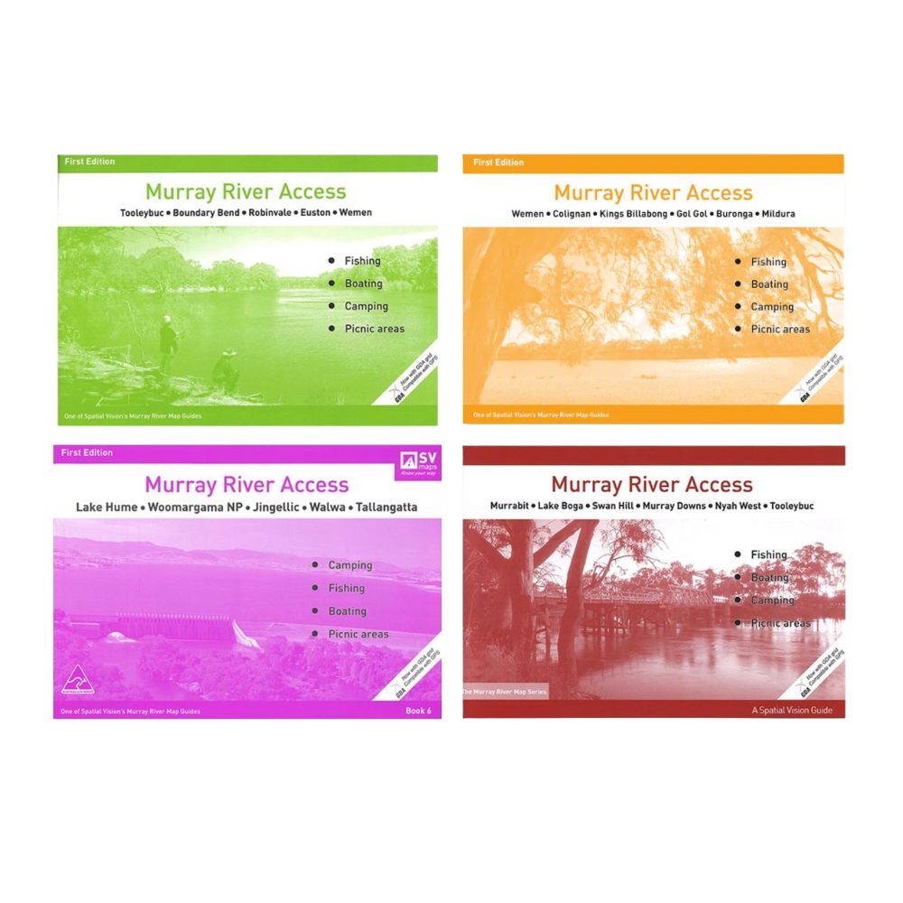
4pc AFN Murray River Access Book #5/6/7/8 Travel/Outdoor Fishing Guide Combo Set
,gravity=Center,allowExpansion)
Collect 38 Everyday Rewards points
,gravity=Center,allowExpansion)
Collect 38 Everyday Rewards points
4pc AFN Murray River Access Book #5/6/7/8 Fishing Guide Combo Set
AFN Murray River Access Book #5 Fishing Guide
Spatial Vision's series of Murray River Access Maps are the best way to find camping, fishing and boating spots along the Murray River. Also includes information on parks and forests, and major walking tracks. SCALE: 1:25,000 COVERAGE: Murrabit, Lake Boga, Swan Hill, Murray Downs, Nyah west and Tooleybuc. IDEAL FOR: Bushwalking, Camping, fishing, mountain biking, exploring and car touring. SIZE: A4 - 297mm wide by 210mm high, 40 page booklet SPECIAL FEATURES: Each map now shows a GDA grid which is compatible with GPS.
AFN Murray River Access Book #6 Fishing Guide
Spatial Vision's series of Murray River Access Maps are the best way to find camping, fishing and boating spots along the Murray River. Also includes information on parks and forests, and major walking tracks. SCALE: 1:25,000 along the river and 1:50,000 abutting Park areas in Victoria and NSW. COVERAGE: Lake Hume, Woomargama National Park, Jingellic, Walwa and Tallangatta. SIZE: A4 - 297mm wide by 210mm high SPECIAL FEATURE: Each map now shows a GDA
AFN Murray River Access Book #7 Fishing Guide
Spatial Vision's series of Murray River Access Maps are the best way to find camping, fishing and boating spots along the Murray River. Also includes information on parks and forests, and major walking tracks. SCALE: 1:25,000 COVERAGE: Tolleybuc, Boundary Bend, Robinvale, Euston to Wemen. IDEAL FOR: Bushwalking, Camping, fishing, mountain biking, exploring and car touring. SIZE: A4 - 297mm wide by 210mm high, 46 page booklet SPECIAL FEATURES: Each map now shows a GDA grid which is compatible with GPS.
AFN Murray River Access Book #8 Fishing Guide
Spatial Vision's series of Murray River Access Maps are the best way to find camping, fishing and boating spots along the Murray River. Also includes information on parks and forests, and major walking tracks. SCALE: 1:25,000 COVERAGE: Mildura, Kings Billabong and the towns of Buronga and Gol Gol. IDEAL FOR: Bushwalking, Camping, fishing, mountain biking, exploring and car touring. SIZE: A4 - 297mm wide by 210mm high, 36 page booklet SPECIAL FEATURES: Each map now shows a GDA grid which is compatible with GPS.
Dimensions Approx.: 21 x 30 cm
Includes:
4 x Fishing Guide Books
Please allow 2-8 business days for delivery.
We ship all across Australia, including all major cities including Sydney, Melbourne, Perth, Brisbane, Adelaide, Canberra, Newcastle, and the Gold Coast.
WARRANTY POLICY
All items from KG Superstore come with a manufacturer's warranty (unless otherwise stated). Please refer to the individual product's description for the specific warranty time-frames.
RETURNS POLICY
If you have a problem with your goods, please contact us. We will investigate your issues and advise you whether your product may be returned and, where required, provide you with instructions on how to return your goods.
Once an item is returned we will either inspect your goods and investigate any claimed defect or in some cases, send the goods to third parties for assessment and/or repair. Where applicable we provide a remedy in relation to your goods.
If we do not believe a remedy is applicable upon inspecting your goods (for example, where we believe the goods have been misused, or there was a failure to use in accordance with manufacturer's instructions, used it in an abnormal way or there has been a failure to take reasonable care), we will reject your claim and return your goods to you. You must cover the cost of return shipping in order to receive goods we have rejected on inspection, and we will provide you with instructions on how to make this payment.
Refunds will be issued using the payment method used for purchase. We aim to process refunds and replacements within 30 days of receipt by us of the original product,
Change of Mind Returns
Please choose carefully as refunds are not normally provided where you have simply changed your mind, made a wrong selection or simply found the goods cheaper elsewhere. We recommend you carefully preview any orders before adding them to your shopping cart and proceeding with your order.
We cannot refund or exchange goods for change of mind or errors you made in your order. We may, at our sole discretion, allow a return or exchange product on a case-by-case basis, provided that the item in question is:
We may provide you with a product exchange only when we receive the returned product. You are responsible for payment of return postage on your order. Change of mind returns are not accepted for Personal Hygiene products, In ear Headphones, intimates, which includes underwear, hosiery, socks, swimwear and adult toys due to hygienic reasons. Remedies for defective goods are still available.
Address Changes
If you enter the incorrect name or shipping details and the item is returned to us via Australia Post, you will be subject to a RTS (return to sender) fee if we are unable to change the details before dispatch, and well as a reshipping fee (dependent on the items weight). We are not responsible for these changes if there is a mistake entered by the buyer.
Defective Goods
All goods sold by KG Superstore come with guarantees that cannot be excluded under the Australian Consumer Law. You are entitled to a replacement or refund for a major failure. You are also entitled to have the goods repaired or replaced if the goods fail to be of acceptable quality and the failure does not amount to a major failure. Where applicable, you may make a claim in relation to goods that are faulty in accordance with our 12 month warranty. This warranty only applies where specifically advertised in the products listings.
GTIN: 0677478408555
Estimated Delivery Time Frame:2-7
Ask a Question About This Product
Reference ID: 14445294