
Crown & Andrews - Antique World Map 1652 by Nicholas Visscher Puzzle 1000pc

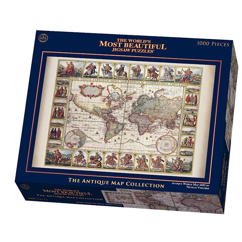
Claes Janszoon Visscher the Elders world maps are among the most spectacular world maps published in the 17th Century. This map is one of four world maps with decorative panels issued by Visscher between 1614 and 1652. In 1639 Visscher based a two hemispheres map on Mercators projection in the style of Blaeu and Jansson. This example is the final state of that map from the year 1652 which is engraved in the lower right side.
Known as the Twelve Caesars Map, it shows 12 roman emperors in full ceremonial regalia mounted on horses. In each corner is a representation of Europe, Asia, Africa and America. Six scenes show costumed figures in the dress in each of regions. The cartography is very up to date for the period, showing the discovery of Hudsons Bay and the St Lawrence river. The Straits of Le Marie and Magellan are shown, with the massive Magellanica Sive Terra Australis Incognita. Beach is still shown in the reigon that would become modern Australia, based upon reports from Marco Polo. The early Dutch discoveries in what would become northern Australia are shown. The California Coastline appers, heading north towards the Straits of Annian, only a few short miles from North East Asia.
Size (approx): 68 x 48cm
Ages: Adults
RETURNS
FAULTY PRODUCTS
Copyright 2024 MyDeal.com.au - © All rights reserved


